As a mariner, and an app developer I can tell you that the best ideas for app features occur to you when you actually need them.
Recently we received orders to go alongside a vessel in a distant port, and we needed to monitor the weather for that location since the general weather outlook was bad. Mariner Studio’s weather map feature already let me long-press any location on the map and drill down to hourly forecasts—perfect for wind data. But I was missing a crucial piece: wave conditions.
So you know what we had to do. Build it!
What We Built:
The Problem
Professional mariners need to make go/no-go decisions based on both weather and sea conditions. Wind speed alone doesn’t tell the whole story—swell height, wave period, and wave direction are equally critical when planning alongside operations, transits through exposed waters, or any operation where sea state matters.
The Solution
We’ve now integrated comprehensive hourly wave data directly into Mariner Studio’s remote location weather feature. Here’s what you get:
For Every Hour at Any Location:
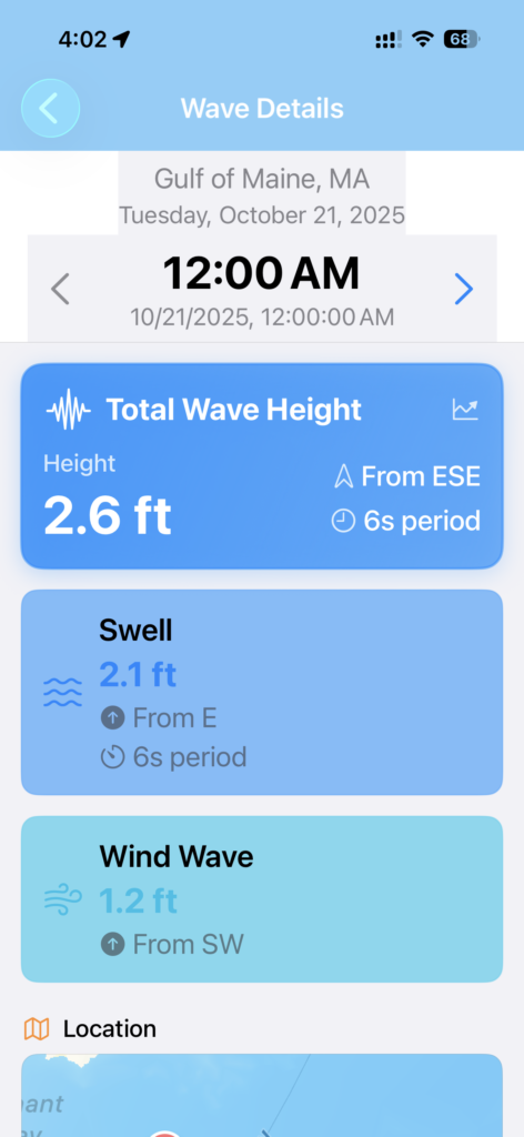
- Total Wave Height – Combined sea state in feet
- Wave Direction – Cardinal direction waves are coming from
- Wave Period – Time between wave crests in seconds
- Swell Height – Long-period swell component
- Swell Direction – Direction of dominant swell
- Wind Wave Height – Short-period wind-driven waves
- Visual Map – See wave and wind directions on an interactive map
How to Use This Feature
Step 1: Access Remote Location Weather
- Open Weather Map from the main menu
- Long-press on any location you want to monitor
- Tap the location marker that appears
- Select “View Hourly Forecast”
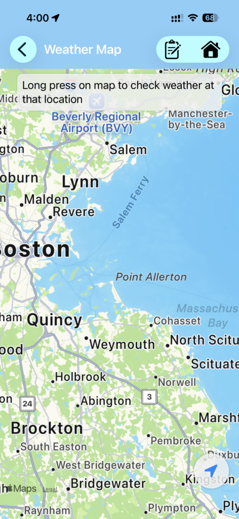
Long press weather map location
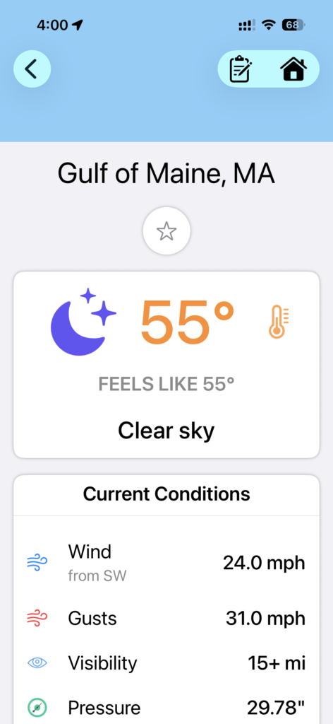
View local weather for that location
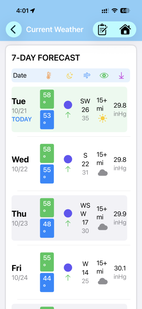
Scroll down to the daily weather section and select day
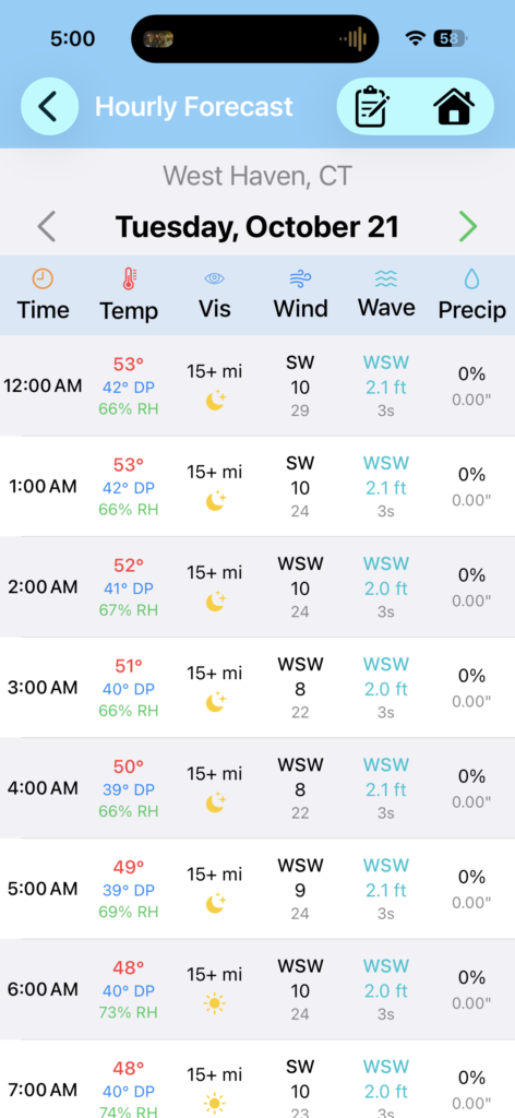
View the hourly wave data. Tap wave data for expanded info
Step 2: View Wave Data
In the hourly forecast table, you’ll now see a Wave column on the right side showing:
- Wave direction (cardinal: N, NE, E, etc.)
- Wave height in feet
- A wave icon (🌊) when data is available
Step 3: Get Detailed Wave Information
Tap any hour’s wave data to open the full wave detail screen:
- Total Wave Card – Large, prominent display of combined wave height
- Swell Information – Separate swell height, direction, and period
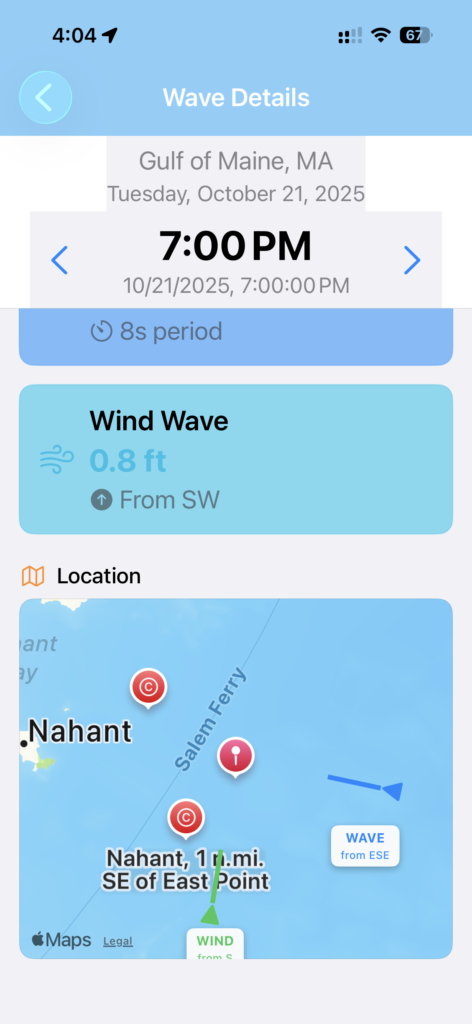
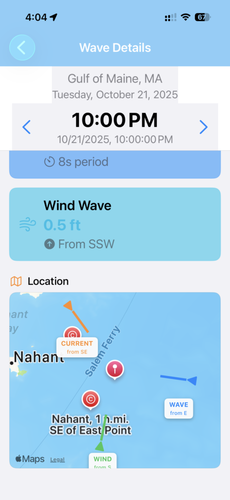
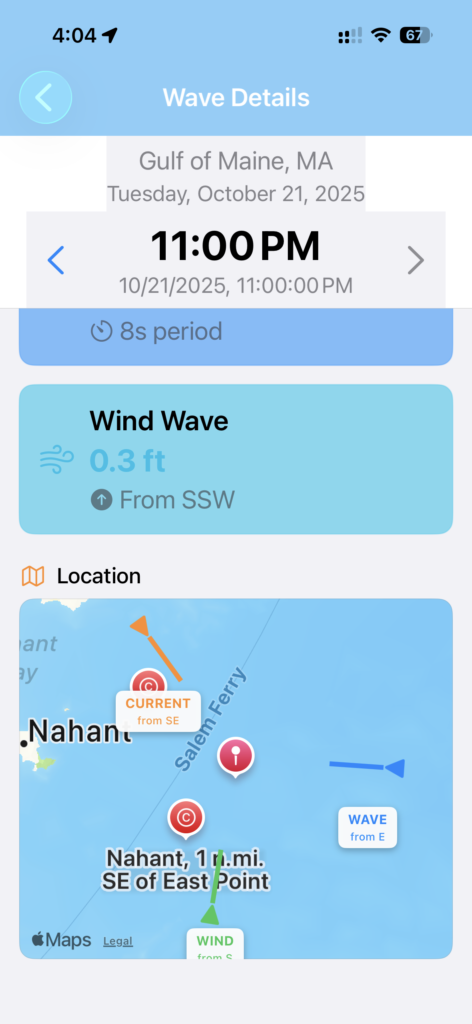
- Wind Wave Data – Wind-driven wave component
- Interactive Map – Visual representation with directional arrows showing both wave and wind direction
Step 4: Navigate Through Time
Use the < Previous / Next > buttons to check conditions hour by hour throughout the day.
Real-World Use Cases
Alongside Operations
Check wave conditions at the destination port to plan your approach and determine if conditions are suitable for safe alongside operations.
Passage Planning
Evaluate sea state along your intended route by checking multiple waypoints to identify the smoothest weather window.
Crew Safety
Make informed decisions about deck operations by knowing exact wave conditions hours in advance.
Anchor Watch
Monitor developing sea conditions at anchorages to anticipate when you might need to adjust scope or reposition.
Fishing Operations
Understand swell patterns to find protected waters or optimal conditions for different types of fishing operations.
Technical Details: How It Works
Mariner Studio pulls wave data from Open-Meteo’s Marine API, which provides:
- Global coverage for marine areas
- Hourly resolution for 7-day forecasts
- High-accuracy wave modeling
- Separate swell and wind wave components
The data automatically converts from metric to imperial units (meters to feet) and calculates human-readable cardinal directions from degrees.
When Wave Data Isn’t Available
Not every location has marine data (inland areas, for example). When you tap a location without wave data, the app will:
- Still show full hourly weather (wind, temperature, precipitation)
- Display “N/A” in the wave column
- Show a “No Marine Data Available” message if you tap the wave details
This is normal and expected for non-marine locations.
Why This Matters
Maritime weather apps often force you to check multiple sources: one app for wind, another for waves, a third for tides. That’s inefficient and dangerous when you’re making time-critical decisions.
Mariner Studio consolidates everything:
- Current location weather
- Remote location weather via map
- Hourly forecasts with wind data
- NEW: Hourly wave data
- Tide predictions
- Current predictions
- Navigation units (buoys)
- Route planning with weather integration
All in one app, built by mariners for mariners.
What’s Next?
This update was driven by real operational needs on the water. Have ideas for what we should build next? We’re always listening to feedback from professional mariners and recreational boaters alike.
Features currently in development:
- Enhanced route weather integration
- Multi-day wave forecasts
- Custom alert thresholds
- Tide and current station sync across devices
Try It Today
Mariner Studio is available now on the App Store for iOS.
Subscription: $2.99/month gets you unlimited access to all features
Free Version: Try every feature once per day
The next time you need to check conditions at a distant port, you’ll have everything you need—wind, waves, and weather—right at your fingertips.
Built by professional mariners who understand that good weather intelligence isn’t a luxury—it’s a safety requirement.
Download Mariner Studio for Apple / iOS: https://apps.apple.com/us/app/mariner-studio/id6744251295
Download Mariner Studio for Android: https://play.google.com/store/apps/details?id=com.companyname.marinerstudio&hl=en_US
Questions or feedback? Contact us at [email protected]
Tags
#MaritimeWeather #ProfessionalMariner #WaveForecasting #MarineNavigation #WeatherApp #iOS #BoatSafety #CommercialMaritime #SeaState #MaritimeSoftware